Independent Directions to this Site: From Boulevard des Allumettières or Highway 148, take the Chemin Eardley exit in Aylmer. Turn right or northwest onto Chemin Eardley or the continuation of Highway 148 and proceed 3.6 km to Chemin Terry-Fox. Turn left or south on Terry-Fox.
Ottawa River West: Quebec Route Directions: From the northwest end of Chemin Queen's Park, return 0.6 km to its junction with Chemin des Boulders. Turn left or north on Boulders and go 0.8 km to Chemin Eardley or Highway 148. Proceed 1.3 km NNW on Eardley to Chemin Terry-Fox. Turn left or south on Terry-Fox.
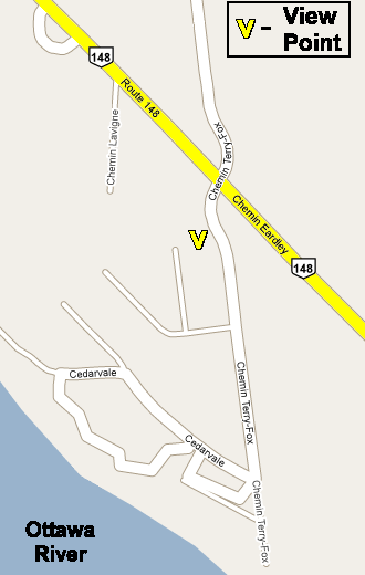
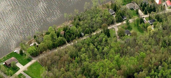
Site Description and Birding Information: The view from the north end of Terry-Fox is panoramic and, as such, provides a marvelous vantage for watch migrating raptors, especially in spring. The southern portion descends into a mixed woodland habitat, with a road to the northwest following the shore for cottage access.
Highway 148 northwest of here as far as Breckenridge often has good panoramic views. Keep your eyes peeled. A Western Kingbird was seen to the river side of the road approaching Breckenridge in 1999.
Ottawa River West: Quebec Route Directions: From the south end of Chemin Terry-Fox, return 1.3 km to its junction with Chemin Eardley. Turn left or northwest on Eardley or Hwy 148. Proceed 6.6 km northwest on Eardley to the next site on this route, Breckenridge.