NeilyWorld Birding Ottawa - Listers' Pages |
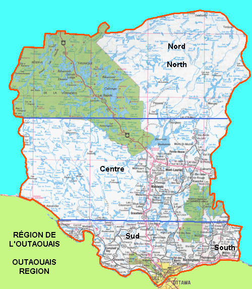
The Outaouais, used by Le club des ornithologues de l'Outaouais (COO) as its major focus, is entirely within the province of Quebec and is defined as follows. It is bounded on the south by the provincial border in the Ottawa River; on the west by the Dumoine River and the western limit of La Vérendrye Reserve; on the north by the reserve's northern boundary and the Capitachouane River, then follows the road from Clova to Parent, passing Dépôt-Échouani; and on the east by Lac Dandurant, Némiscachingue River and Lake, the route along Line Creek, then a series of lines and roads to the northern extremity of the Kiamika Reservoir, the shore of this reservoir, a route joining the reservoir to the village of Ste-Véronique, the road toward Lac Saguay, a series of roads going to Lac Bruchési, the eastern limit of the Papineau-Labelle Reserve (including Lac Castor and Lac La Minerve), the road going to Vendée and Huberdeau, and, finally, the Rivière Rouge to the Ottawa River.- Guide d'observation des oiseaux de l'Outaouais (Club des ornithologues de l'Outaouais - 1985)