THE BURNT LANDS - RAMSEY CONCESSION 11B
Spring: ** Summer: ** Fall: ** Winter: **
Independent Directions to this Site: From Highway 417 (The Queensway) take exit 155 (March Road or Regional Road 49). Turn left or southwest onto March Road and follow it for 14.0 km to Martin Street North (Lanark 17) in Almonte. Turn right or northwest on it and drive 5.5 km to Blakeney Road at Blakeney. Turn right or northeast onto it, following Lanark 17, and go 0.5 km to Ridge Road. Turn right from Lanark 17 but actually continue northeast onto Ridge Road and go 0.8 km to the turnoff, on the right or southeast, to The Burnt Lands - Ramsey Concession 11B.
Mississippi River Valley Route Directions: From the Blakeney Rapids Park, turn right or east on Blakeney Road and proceed 0.9 km Martin Street North (Lanark 17) at Blakeney. Continue straight to the northeast on Blakeney Road (now Lanark 17) for 0.5 km to Ridge Road. Turn right from Lanark 17 but actually continue northeast onto Ridge Road and go 0.8 km to the turnoff, on the right or southeast, to The Burnt Lands - Ramsey Concession 11B.
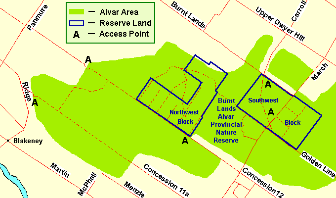 Map of the Burnt Lands area
Site Description and Birding Information: The maintained portion of this dirt road ends about a hundred metres from Ridge Road, but the rough track continues to eventually reach Ramsey Concession 11A, coming northwest from Almonte. It has at least one side track heading northeast to eventually join Ramsey Concession 12. These tracks are best walked, both for enjoying nature better and being worry-free about your vehicle's undercarriage.
A good variety of wooded and open alvar land make this an interesting site to explore. It makes a good alternative route in The Burnt Lands north end.
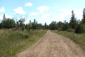 Dirt Track through the Alvar
|
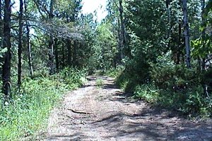 Woodland along the Way
|
Mississippi River Valley Route Directions: From The Burnt Lands - Ramsey Concession 11B, return northwest to Ridge Road and turn right or north onto it. Proceed 1.2 km to Panmure Road and turn right or northeast onto it. Drive 1.2 km to Ramsey Concession 12. Turn right or southeast into to the next site on this route, The Burnt Lands - Ramsey Concession 12 North.
Return to Mississippi River Valley.
Return to Birding Ottawa Table of Contents.
|