CARLETON PLACE
Spring: ** Summer: * Fall: ** Winter: **
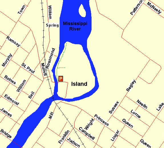
Independent Directions to this Site: From Highway 417 (The Queensway) take exit 145 (Highway # 7). If driving east, a 0.8 km offramp brings you to right or southeast, then south, onto Highway # 7. If travelling west, the offramp to the right brings you southwest, then south, 1.4 km to meet the eastbound traffic on Highway # 7. From here, both groups will now follow Highway # 7 south, then southwest, 20.5 km to Highway # 15 and the Franktown Road. Turn right or northwest onto Franktown and follow Franktown Road, Moore Street and Bridge Street (each flows into the next) for 2.2 km to Mill Street on the right. Turn right or northeast onto Mill and drive 0.6 km, crossing to a small island in the Mississippi River, passing the plant on the right, making a sharp left turn and stopping at a small parking spot at the trailhead just before the road leaves the island again.
Mississippi River Valley Route Directions: From Highway 417 (The Queensway) take exit 145 (Highway # 7). If driving east, a 0.8 km offramp brings you to right or southeast, then south, onto Highway # 7. If travelling west, the offramp to the right brings you southwest, then south, 1.4 km to meet the eastbound traffic on Highway # 7. From here, both groups will now follow Highway # 7 south, then southwest, 20.5 km to Highway # 15 and the Franktown Road. Turn right or northwest onto Franktown and follow Franktown Road, Moore Street and Bridge Street (each flows into the next) for 2.2 km to Mill Street on the right. Turn right or northeast onto Mill and drive 0.6 km, crossing to a small island in the Mississippi River, passing the plant on the right, making a sharp left turn and stopping at a small parking spot at the trailhead just before the road leaves the island again.
 Map of Carleton Place area
Site Description and Birding Information: This beautiful patch of green along the river, near downtown Carleton Place, has a short trail along the shore and some rapids that remain open in winter. The open water in winter attracts some waterfowl, such as Common Goldeneye, and sometimes a Belted Kingfisher. The vegetation has a distinct southern element, with a stand of Hackberry trees being one of the main components of this maturing forest fragment. The whole island is unfortunately zoned industrial, so enjoy it while you can!
The Mississippi Valley Field Naturalists (MVFN) are based here in Carleton Place. Check there website for more information. Also see Daniel Brunton's Nature and Natural Areas in Canada's Capital published in 1988 by the Ottawa Citizen for more information on this site.
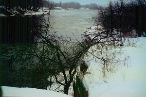 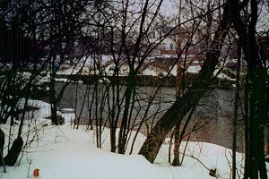 Mississippi River at Carleton Place
Mississippi River Valley Route Directions: From the parking area on the island at Carleton Place, proceed west across the bridge and at 0.1 km turn right or NNE onto Rosamond Street. Go 0.2 km NNE on Rosamond and turn left or northwest on Gemmill Street. Take Gemmill 0.1 km to William Street and turn right or NNE onto it. Follow William NNE for 0.5 km to Town Line East or Lanark 7B & 29 and go straight or NNE onto it. Drive NNE for 2.0 km to the turnoff on the right or east to Glen Isle. Head east on the road to the island for 0.7 km, where you cross the bridge and begin to explore the loop's next site, the Glen Isle.
Return to Mississippi River Valley.
Return to Birding Ottawa Table of Contents.
|