MONTAGUE BOUNDARY ROAD
Spring: ** Summer: *** Fall: ** Winter:**
Independent Directions to this Site: From Highway 417 (The Queensway) take exit 145 (Highway # 7). If driving east, a 0.8 km offramp brings you to right or southeast, then south, onto Highway # 7. If travelling west, the offramp to the right brings you southwest, then south, 1.4 km to meet the eastbound traffic on Highway # 7. From here, both groups will now follow Highway # 7 south, then southwest, 10.9 km to Regional Road 3 or the Dwyer Hill Road. Turn left or southeast onto Dwyer Hill and follow it 11.2 km to the Franktown Road. Turn right or southwest onto it and go 3.2 km to the Ashton Station Road. Turn left or southeast onto it and proceed 3.6 km to Beckwith Road. Turn right or southwest onto it and drive 1.3 km to the Montague Boundary Road. Turn left or southeast onto the north end of the Montague Boundary Road.
Marlborough Forest Loop Route Directions: From wherever you are on the William Campbell Road, return northeast the Montague Boundary Road. Turn left or northwest onto the Montague Boundary Road and enter the south end of the Montague Boundary Road.
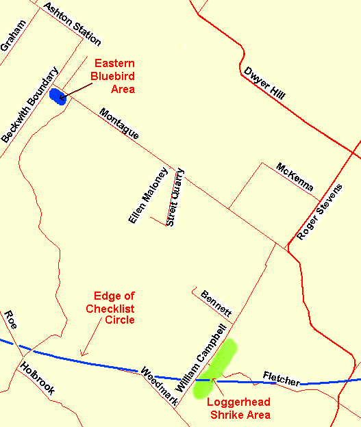 Map of the Montague Boundary Road Area
Site Description and Birding Information: The 6.5 km of this gravel road between William Campbell and Beckwith Roads consists of overgrown farms, wooded swamps, and, at the north end, some pasture land / overgrown fields. Eastern Bluebirds breed in the latter area. The overgrown fields throughout should be scanned for Loggerhead Shrike, the habitat is good and the proximity to known sites makes it a possibility. Black-billed Cuckoo also breed here (4 were found July 1, 2003).
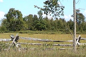 Montague Boundary Road
Marlborough Forest Loop Route Directions: From the north end of the Montague Boundary Road, at Beckwith Road, turn right or northeast onto the Beckwith Road and proceed 1.3 km to Ashton Station Road. Turn left or northwest onto it and go 1.4 km to Purdy Road. Turn right or northeast onto it and drive 3.0 km to Dwyer Hill Road. Turn right or southeast onto it and proceed 5.3 km to the pulloff (either side) on the second curve of the S-bend for the next site in our loop, the Old Rideau Trail on Dwyer Hill Road.
Return to Marlborough Forest Loop
Return to Birding Ottawa Table of Contents
|