SW OF PADEN ROAD
Spring: ** Summer: ** Fall: ** Winter:**
Independent Directions to this Site: From Highway 416 take exit 49 (Roger Stevens Drive). If southbound, a 0.4 km offramp dumps onto Bankfield, where you will turn right or southwest. If northbound, the 0.4 km offramp brings you to Bankfield, where you will turn left or southwest onto it and in 0.4 km join the southbound offramp traffic. Both groups will now follow Roger Stevens Drive southwest 8.2 km to Malakoff Road. Turn left or southeast onto Malakoff Road and go 1.7 km to Gallagher Road. Turn right or south onto Gallagher Road and proceed 4.4 km to its junction with Harnett Road. Turn left or southeast and drive 2.6 km to Paden Road. Turn right or southwest onto Paden and drive 7.2 km to the Dywer Hill Road. Cross Dywer Hill Road and park on the other side of it at the entrance to the track extending SW of Paden Road.
Marlborough Forest Loop Route Directions: From the crossing of Brassils Creek at Paden Road, continue southwest 0.7 km on Paden to the Dywer Hill Road. Cross Dywer Hill Road and park on the other side of it at the entrance to the track extending SW of Paden Road.
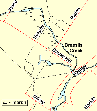 Map of the Area SW of Paden Road
Site Description and Birding Information: Walk into this trail through second growth and abandonned farmland for about 0.7 km to a swamp with lots of standing dead trees. Olive-sided Flycatcher habitat, and sightings in the past not far away - you never know. This old roadbed reaches Gilroy Road eventually (2.8 km to where Gilroy heads southeast). Around 1.6 km from Dwyer Hill Road the trail crosses a major snowmobile trail and about 2 km from Dwyer Hill Road the trail crosses the Rideau Hiking Trail.
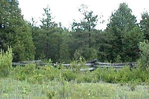
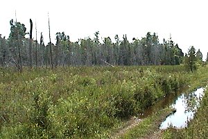 Views of the Area SW of Paden Road
Marlborough Forest Loop Route Directions: From the track extending SW of Paden Road from Dwyer Hill Road, proceed left or northwest on Dwyer Hill Road for 0.6 km to a large open marshy area. Park on the side of the road where you can get well off and scan the next site in the loop, this Dwyer Hill Road Marsh.
Return to Marlborough Forest Loop
Return to Birding Ottawa Table of Contents
|